By: Timothy W. Shire
For many years when things were piling up I could always find solace in climbing into my aircraft and getting above it all. I realise that it seems like I was running away but to me it gave me some perspective on things. I suspect most people have their places they go to get away from it all and get that sense of perspective, think things out and be able to concentrate on what is really and truly important.
These pictures were actually taken on a business trip, as a principal several times a year we were called into Whitehorse for a series of meetings. For me this was an opportunity to use the aircraft
 and get
some compensation
and get
some compensation for the costs involved.
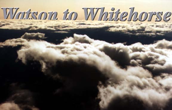
Flying along side a rift in the clouds the mountains well below and the chunky cumulus covering their tops there was considerable need for situation awareness. A person had to know where you were taking the aircraft and understand the extreme hostility of what lay within and below those beautiful clouds.
So essentially the adventures in the air were little different from those on the ground except that in the air you the pilot probably had considerably more control of the situation and the dangers were always more obvious but much more lethal.
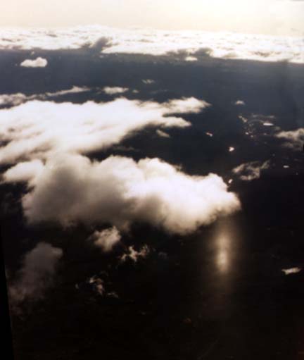
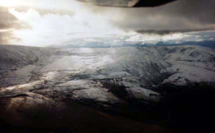
The broken cloud on the right reveals the unfrozen surface of a lake below in the flat lands between Watson Lake and the Rancheria Range, this fifty mile stretch of flat land West of the Laird River is a section of the Tintina Trench but is covered with moraines and kettle lakes.
In this picture the shadows of the clouds mask the flat treed country below as this picture is viewing the land from cruise altitude of 10,500 feet.
 The flat land
West of the
The flat land
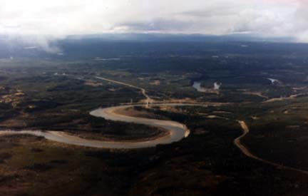
West of theLaird (seen at right) stretches
out and the meander of the Laird wanders along slowly as it heads toward the canyon only miles away to the East.
In the centre of the picture is the Laird bridge and on the West bank is the Kaska village of Laird.
The ragged October clouds sit right on the mountain tops meaning that this flight would have to traverse the valleys or stay above the openings in the cloud cover. The Watson Lake runway is immediately behind us as we climb through 4,000 and level off at four point five for the first part of the trip.
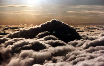
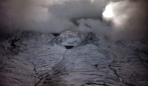
In the picture below, this is what you must not go near, the damp air from the coast has worked its way up the mountain slopes and turned to dense clouds right below the mountain tops at six point six. New fall snow has turned them white and the little catch basin ponds are not frozen over but coal black.
Here the clouds sit higher and a pilot can fly down the valleys with some space to spare in between the mountain tops and the cloud bases which will be filled with ice. An aircraft that enters these clouds at this time of the year will quickly be covered in clear, but very heavy ice shortly there after its flying capabilities will end.
As you can see in this picture vegetation is rare above the 4,000 foot level as the tops of the mountains are almost completely barren. This area of the Yukon has valuable materials on those mountain tops with gold, silver and other precious metals exposed.
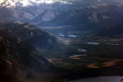
In this picture the clouds are behind us and we look down valley after valley as this is the sort of terrain that one sees from Teslin to Whitehorse. Forests on the valley floors, moose pastures, rivers, lakes and the unknown.
From 10, 000 feet the petty issues of day to day life seem smaller and more insignificant then the greater scheme of things. Successfully crossing the mountains and meeting the challenge of navigation means that you are still alive for in such an adventure everything boils down to the basics. Survival or obliteration helps to clear up uncertainty, decisions are easier to make when you eliminate the "perhaps" and "maybes", the process of factoring and establishing only two alternatives clears up a lot of situations.