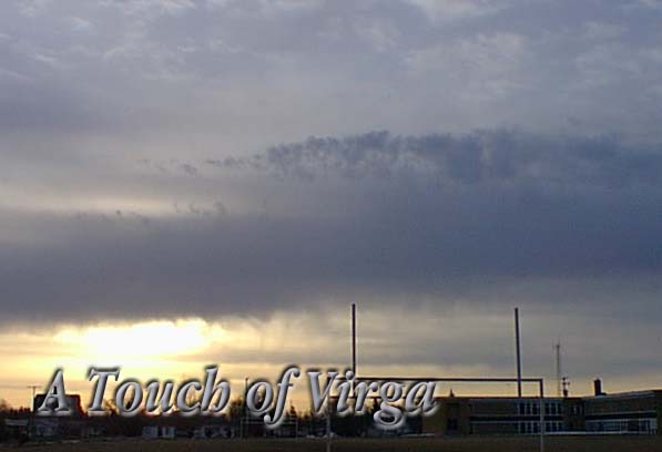
This mornings interesting cloud
formation definitely indicates a
seasonal change. Though we have
warmer daytime temperatures the
sky has continued in its winter mode,
until this morning and above us we
see the decoration of spring. The
low band of stratocumulus is often
associated with showers and as you
can see the trailing fingers of
precipitation are known as "Virga".
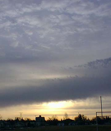
Above the status layer we can see
puffs of cumulus cloud and in the
the picture on the right these layers
are even more aparent.
These clouds are accompanied by
a modest East wind which of course
indicates a low pressure area to the
South of us bringing warm moist air
up over the Northern prairies. We
are in the mixing zone between the
colder arctic air and the moderate
warmer air to the South and as a
result we should see some minor
precipitation. For more rainfall
we need to be seeing much
larger cloud formations associated
with even warmer air masses
that would form nimbus clouds.
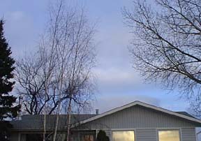
However, even the prospects of nimbus clouds
abound as you can see in the image taken looking
West over our house and you can see that while
the East has this pleasant cumulus situation
we have larger cumulus clouds forming
to the West.
These pictures were taken right around eight
this morning and the five degree
temperature is most welcome as is the
gentle seven knot wind from
the South East.