Run off appears to have peaked
FTLComm - Tisdale - Wednesday, April 13, 2011
Comparing the rate of flow and the extent of river flooding, the change from Monday until today has only been a modest increase. However, for the river to be flowing steadily at the present rate for these four or five days, that is unusual as the spring run off in most years lasts about six days in total and with the river appearing to be at a steady flow today, that would suggest a run off of about ten days. That is a lot of water but fortunately, it is being released fairly steadily by the waterways upstream. I went north of town this afternoon and discovered that the crest has not reached some areas I have seen flooded i n other years but the ice lines suggest that the levels in some creeks was about a foot above the present levels.
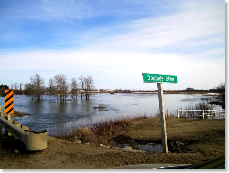
No properties in Tisdale or the immediate area are in danger with only the usual damage to the Riverside Golf Course and the dog Hide Trail.
The Shand River that flows from north of Porcupine Plain, north of Weekes and toward Hudson Bay is in a flood stage and well over its banks but within the range of what it does in a normal year.
When we look at the spring run off we all look at our own situation and need to realise that this year the run off is general for almost all of the province with many areas having record water levels. The water that leaves this area flows through the Carrot River to the massive delta south of Cumberland House then out the Saskatchewan River system to Hudson Bay. But, south of Greenwater the water makes its way into that poorly drained Quill Lakes area then eventually joins with all of the water south toward Manitoba.
On Sunday afternoon we were returning to Tisdale after a visit to the Swift Current area and the Regina Plain area is a lake for the most part and that water really has no where to go but will have to dry up right there in those fields between Regina and Bell Plain. North of Regina there had been a heavy snow cover, now melted but it has various routes to make its way into the Qu'Appelle system.
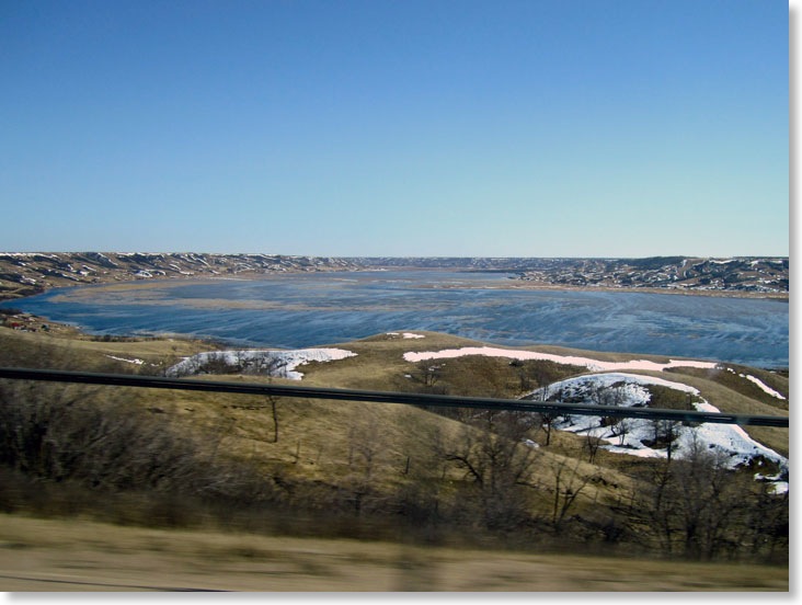
The Qu'Appelle Valley between Regina and Southey on Sunday is now a lake, a lake which has to drain eastward down the valley through the chain of lakes eventually getting into the Assinaboine River heading through Brandon then to Portage la Prairie where the diversion will send most of the water north into Lake Winnipeg. But, some will make its way into Winnipeg expected to arrive there the first week of May when the Red River crests in the Manitoba capital. The Manitoba experts are confident that the diversion and the Red River by-pass will do the trick. The only unpredictable part of the story is rain and snow that might really change the levels and speed of the water movement in the rivers and streams of western and southern Manitoba. Live web cams at Brandon, Portage, the floodway gates south of Winnipeg and at the Forks tell a bit of the story.
Understanding that water runs down hill and that is toward Lake Winnipeg the picture below is what the valley looked like on Sunday afternoon.
As of April 1 the Saskatchewan Watershed Authority produced an excellent map that shows what was expected at that time.
The pictures with this story have the date and time showing when they were taken.