| Same Last Year |
 |
| FTLComm - Tisdale - September 20, 2000 |
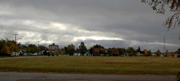
| Each day I jot down a description of the day's weather and post that at the top of
the front page. You may have noticed that beside that line is a link to "Weather Log" and since December 14 1999 we
have kept a log of each day's observations. A surprisingly large number of people
do this themselves, they jot down in their diary or just a notebook the weather each
day. So part of the process of creating each edition of Ensign each day is doing a weather observation, put the results down on the front page then placing today's weather in the log. I used to have today at the top then record each day twice once at the top and the second entry at the same date a year ago. Well the file was just getting to big so a week ago I eliminated the first top entry and only enter the day's weather with last year's weather. As the year has been going along I have noticed how some days we are so close to what it was like a year ago. That was the remarkable thing about yesterday when I discovered for the third year in a row it was raining on September 19. You can have a quick look and see what it was like September 19, 1998, and September 19, 1999. This morning (picture above taken at 8:45) we have a very nasty looking winter sky over us with a Northwest wind blowing +5 degree air around. Though we had a little rain off and on all day yesterday it really was an insignificant amount, just enough to make things damp. 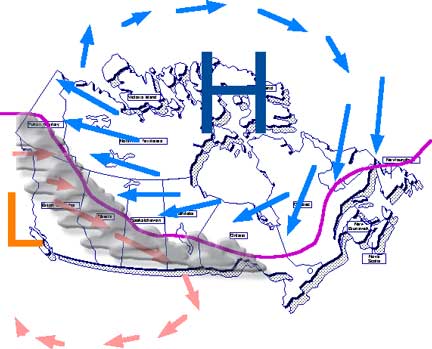 The seasonal process is very dramatic and the reason for the sudden change is that our continental climate is developed high in the Arctic. As the hours of sunlight decline so does the temperature and an intense Arctic High pressure area develops with its clockwise flow of cold arctic air. The southern boundary of this air is the purple line on the map and weather men refer to it as a quasi-stationary front. Out in the gulf of Alaska there is another permanent weather system, a stationary low pressure area over the warm Pacific water running up into the gulf and heating up the air above, this warm wet air moves East across the mountains banging its way along the cold arctic front and giving rain where the two fronts interact. The picture at the top of the page is the scene we see from the ground as warm Pacific air encounters cold arctic air. The high winds the last few days ride out to the South of the purple line as they are produced by a low to the Southwest and an intense high to the Northeast. From now until late February that line, (shown purple above) will move North and South on the map high above it in the upper atmosphere is the "Jet Stream" a stream of air whistling along at speeds often above 100mph. Along the front is a constant line of cloud and most often with it precipitation. To the North of the Quasi-stationary front is cold heavy and very dry arctic air. As we approach December that purple line will move well South of us and we will be in winter. Though this weather pattern is very well established it can be upset. Variations in the temperature of the Pacific ocean can really disturb this traditional weather pattern as has been seen in the recent past few years and this year is likely to see yet another warm and rather short winter. The waters of the Pacific are somewhat neutral this year and it will be the variations that will produce the storms and rapid changes. A mild winter often results from very warm Pacific currents pushing the quasi-stationary front Northward and when that happens it slips East and South giving the North American East coast a miserable time. |