Crooked Lake
Crooked Lake - Wednesday, April 20, 2011 by: Kyle Broda
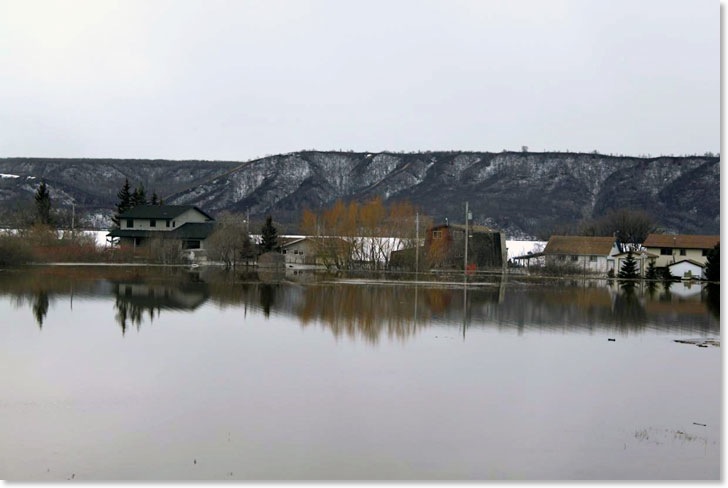
These pictures were taken on Sunday, April 17, before the lake reached its highest level. Crooked Lake is the second last lake in the chain of lakes in the Qu'Appelle Valley with a narrow stream running into the lake on its west end that connects to Katepawa. Crooked Lake drains on its east end into an equally small stream that feeds into Round Lake. Crooked Lake is located north of Grenfell and south of Melville.
As mentioned the valley has the Qu'Appelle river which actually coonects to Buffalo Pound Lake North of Moose Jaw. Most spring years the river will spread out into the valley floor for a few days but the normal amount of winter snow fall is rarely heavy enough to produce much flooding. This year things are different. There was a good layer of snow throughout the area and even small streams got out of control. On the east end of Crooked Lake is the Cowessess First Nation. It was flooded a week ago when water from the hills rushed in forcing evacuation of many of the homes. But from end to end the Qu'Appelle Valley is running almost covering the valley floor. This is a valley that was carved out of the flat prairie land by the melting of glaciers when the ice age ended several thousand years ago.
Each of the lakes in turn have been rising so that Crooked Lake is actually about six feet above its normal summer level. In the pictures taken by Kyle Broda you can see that there is flooding and what is even more ominous is the fact that the lake is still covered in ice. The rising water has floated the ice up and cottage owners and permanent residents along the shores of Echeo, Katepawa, Crooked and Round Lakes are all extremely anxious that the ice will break up and normal Saskatchewan winds will do serious damage to the structures around the lakes.
Crooked Lake reached what is believed to be its high point on Tuesday but it will be several weeks before the threat of ice damage subsides.